
Residential Drone Mapping
Property Assessment:
- Drones can be used to conduct aerial surveys and assessments of residential properties.
- This is particularly useful for real estate agents, property developers, and homeowners looking to assess the condition of roofs, facades, and overall property layout.
Construction and Renovation:
- Drones aid in construction planning by providing accurate topographical data.
- They help monitor construction progress and assess the need for renovations or repairs.
Landscaping and Gardening:
- Drones equipped with sensors can assess soil health and plant conditions.
- They assist in planning landscaping projects and monitoring the growth of gardens.
Insurance Inspections:
- Insurance companies use drones to assess damages to residential properties after natural disasters or accidents.
- This enables faster claims processing and reduces the need for physical inspections.
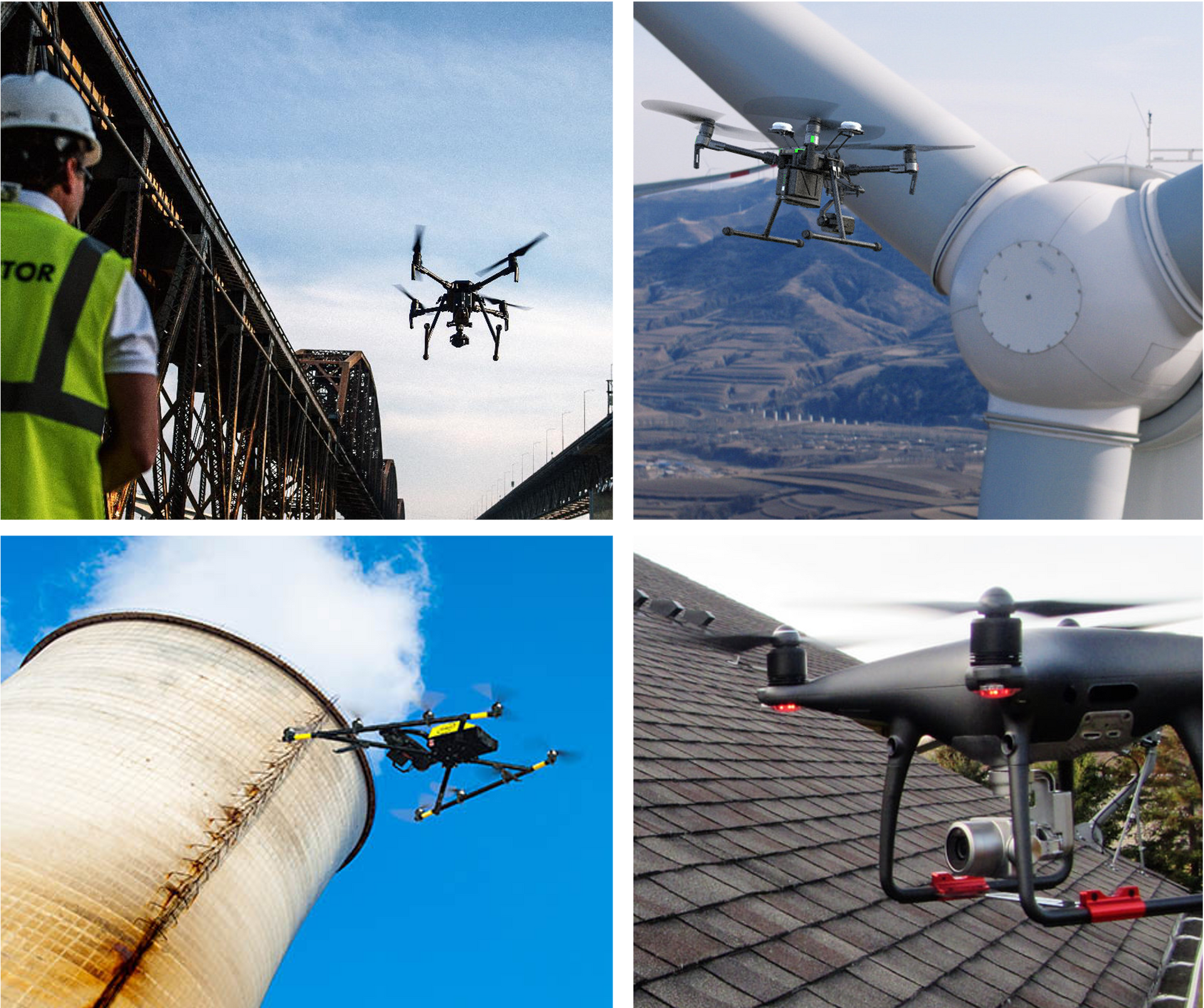
Home Inspections:
- Drones can access difficult-to-reach areas, facilitating thorough home inspections.
- This is useful for identifying potential issues with roofs, chimneys, and other elevated structures.
Commercial Drone Mapping
Surveying and Mapping:
- Drones provide high-resolution aerial imagery for accurate surveying and mapping.
- Industries like agriculture, mining, and infrastructure development benefit from precise mapping data.
Construction and Engineering:
- Drones assist in project planning, monitoring construction sites, and inspecting infrastructure.
- They contribute to improved safety, efficiency, and cost-effectiveness in construction projects.
Precision Agriculture:
- Drones equipped with sensors help farmers monitor crop health, optimize irrigation, and assess field conditions.
- This leads to increased agricultural productivity and resource efficiency.
Energy Sector:
- Drones are used for inspecting power lines, pipelines, and other critical infrastructure in the energy sector.
- They reduce the need for manual inspections, improving safety and efficiency.
Environmental Monitoring:
- Drones aid in environmental studies, monitoring wildlife, and assessing ecological changes.
- They provide valuable data for conservation efforts and environmental impact assessments.
Search and Rescue:
- In emergencies, drones can quickly survey large areas, aiding in search and rescue operations.
- They are equipped with thermal cameras and can access hard-to-reach locations.
Telecommunications:
- Drones assist in the inspection and maintenance of telecommunication towers and antennas.
- This ensures the reliability and functionality of communication networks.
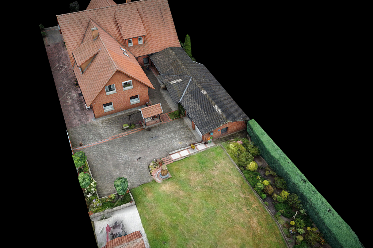
Photogrammetry
Photogrammetry Basics:
- Understand the art and science of creating 3D models from 2D images.
- It's a non-contact and non-invasive technique.
- Capturing Images:
- Start by taking multiple photos of an object, scene, or area from different angles.
- High-quality, high-resolution images are crucial for accurate results.
- Utilize specialized photogrammetry software such as Agisoft, Pix4D or DroneDploy.
- These tools analyze images and generate 3D models
.